for Best Travel/Guide Book!
A Hiking and Snowshoeing Guide
published by CMC Press

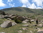
Other Hikes not in the book
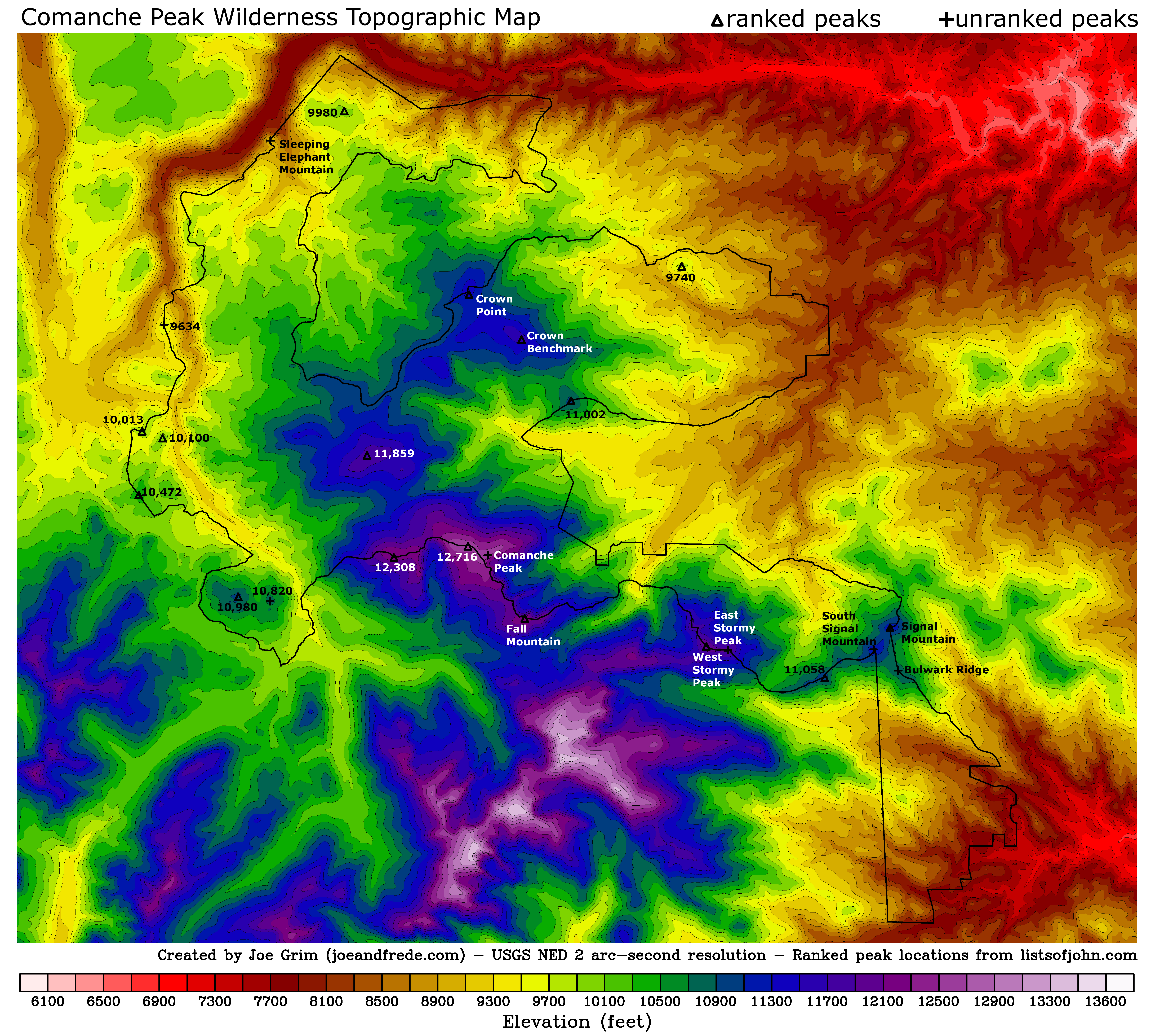
Extra large topo maps
GPSVisualizer Map
Comanche Peak Wilderness areas we have hiked
| Winner of the 2011 Gold Award
for Best Travel/Guide Book! |
Check out the new topographic map | Our other Colorado Hikes | |||
|
Comanche Peak Wilderness Area: A Hiking and Snowshoeing Guide published by CMC Press |
Print-Quality Resolution Version |
Trails and Hikes in the book Other Hikes not in the book Extra large topo maps GPSVisualizer Map Comanche Peak Wilderness areas we have hiked |
||
| Trail/Hike Name | Trail/Hike Stats | Description | Photo Album | Map (Key) | Profile |
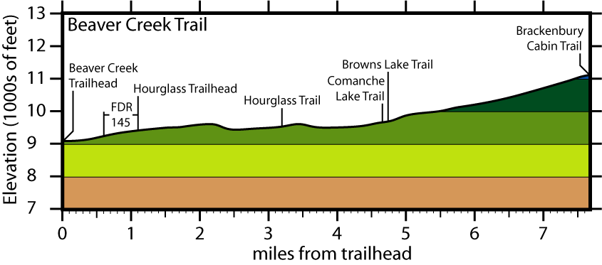
| Beaver Creek Trail | Roundtrip: 14.4 miles Total elev. chg.: 3,306' High elevation: 11,128' Rating: moderate TH open mid-June - late October |
This trail follows its namesake, gently burbling Beaver Creek, for much of its length and eventually tops out near an alpine ridge, where panoramic views and delicate flowers abound. |  |
 |
 |
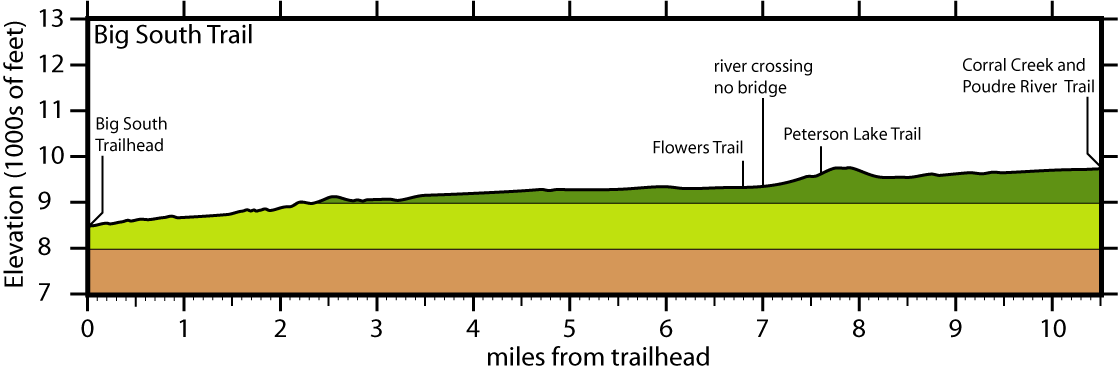
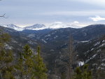
| Big South Trail | Roundtrip: 21.0 miles Total elev. chg.: 2,524' High elevation: 9,704' Rating: moderate TH open year round |
This trail follows along a wild upper stretch of the Cache la Poudre River for its entire 10+ mile length, providing great hiking, fishing and backcountry camping. | 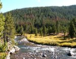 |
 |
 |
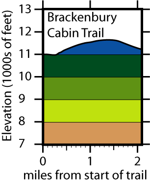
| Brackenbury Cabin Trail | Roundtrip: 10.0 miles Total elev. chg.: 2,323' High elevation: 11,631' Rating: moderate TH open mid-June - late October |
This trail is a good one if you love alpine wildflowers, as it climbs over a broad alpine pass in its short length. Along the way, you get broad sweeping views in nearly every direction. | 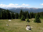 |
 |
 |
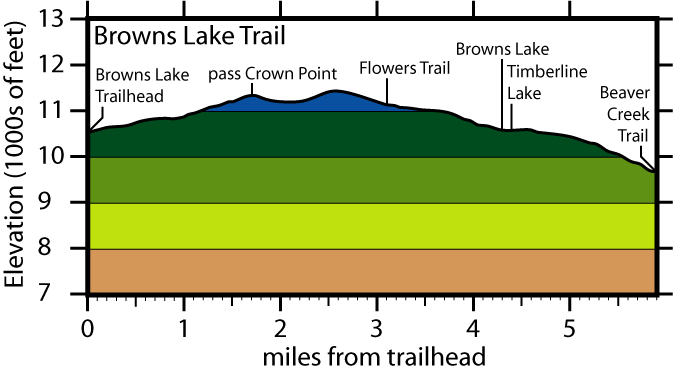
| Browns Lake Trail and Crown Point Hike |
Roundtrip: 11.8 miles Total elev. chg.: 3,168' High elevation: 11,400' Rating: difficult TH open mid-June - late October |
The trailhead lies only 600 feet below timberline, so this trail provides quick access to the alpine tundra and its multitude of wildflowers. Beautiful Browns and Timberline Lakes are also highlights of this trail. |  |
 |
 |
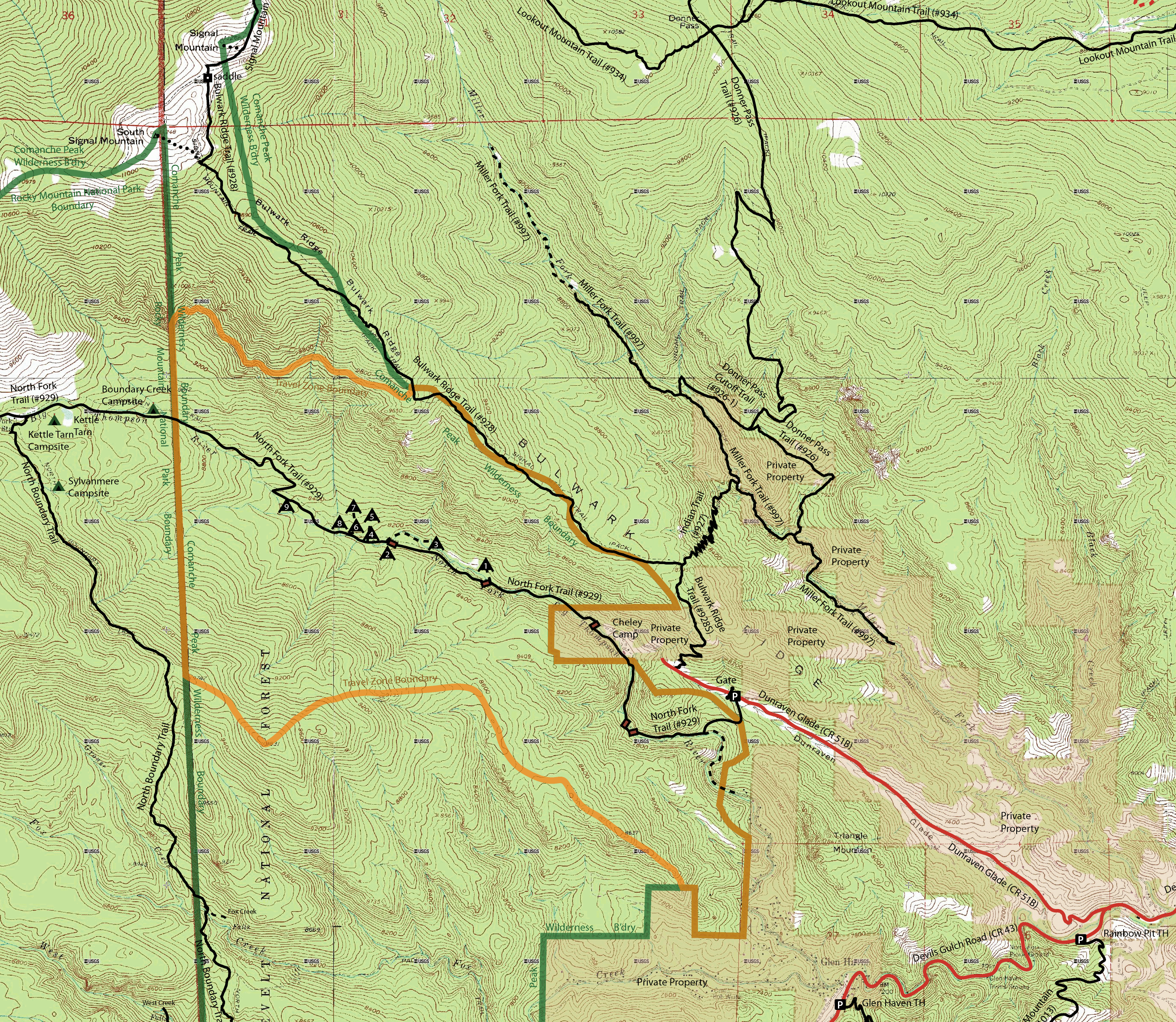
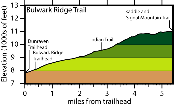
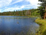
| Bulwark Ridge Trail (and South Signal Mountain) |
Roundtrip: 10.8 miles Total elev. chg.: 3,511' High elevation: 11,042' Rating: difficult TH open year round |
This all-season trail ascends Bulwark Ridge through nearly continuous forest and a few small meadows. The long hike is well worth the effort though, as it provides access to Signal and South Signal Mountains. |  |
 |
 |
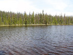
| Comanche Lake Trail | Roundtrip: 9.2 miles Total elev. chg.: 1,847' High elevation: 9,984' Rating: moderate TH open mid-June - late October |
This short trail branches off of the Beaver Creek Trail and winds its way through dark subalpine evergreen forest to quaint Comanche Lake, a great place for those hikers and fishermen seeking solitude. | 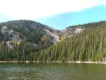 |
 |
 |
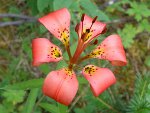
| Comanche Peak Hike via the Old Morril Trail | Roundtrip: 12.8 miles Total elev. chg.: 3,956' High elevation: 12,709' Rating: difficult TH open mid-June - late October |
This hike takes you from the Emmaline Lake Trail, through evergreen forest and on up through the krummholz zone, eventually topping out at the sentinel of the wilderness area, Comanche Peak. Awesome views await you at the top! | 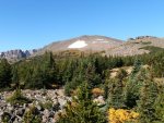 |
 |
 |
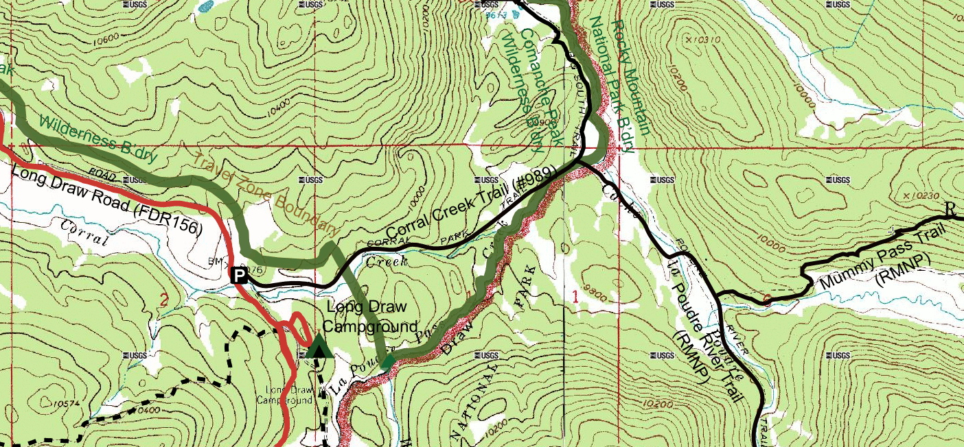
| Corral Creek Trail (and hike to Mirror Lake in RMNP) |
Roundtrip: 2.6 miles Total elev. chg.: 363' High elevation: 10,038' Rating: easy TH open early July - late October |
This short trail follows Corral Creek, passing through forest and meadows along the way. It’s also a great jumping off point for those seeking to explore the remote northwestern corner of Rocky Mountain National Park. | 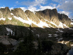 |
 |
 |
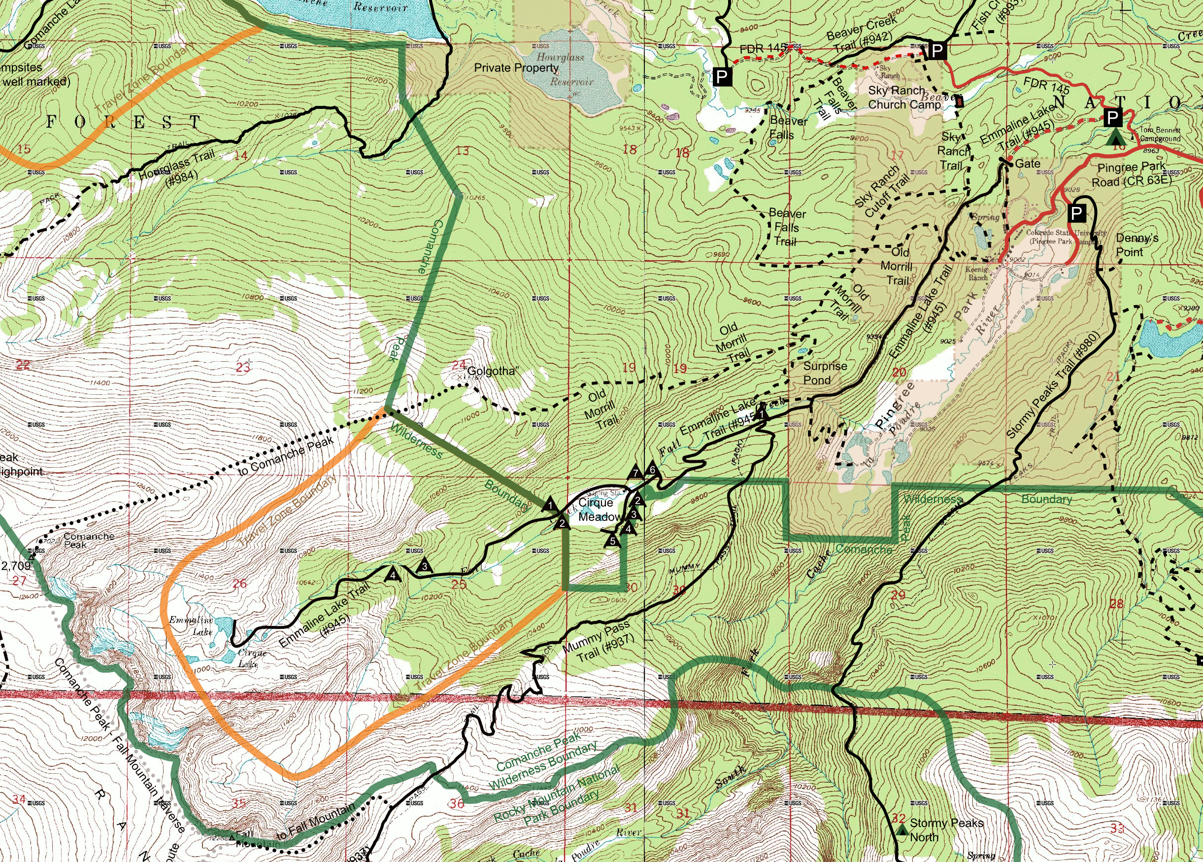
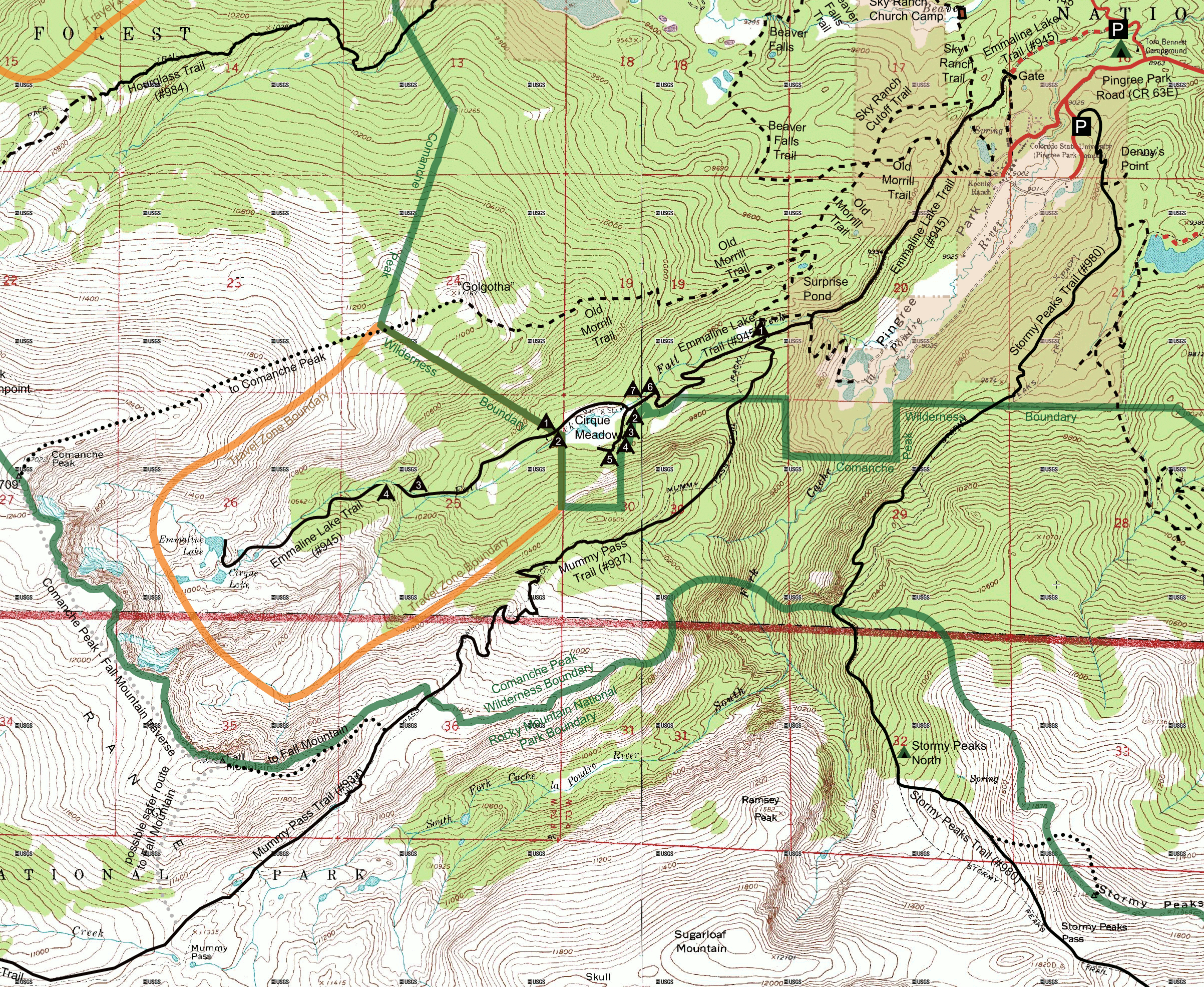
| Emmaline Lake Trail | Roundtrip: 11.8 miles Total elev. chg.: 2,178' High elevation: 11,015' Rating: moderate TH open mid-June - late October |
This trail starts by passing through the charred remains of the 1994 Hourglass Fire, then enters into dense cool forest where it remains until you reach beautiful swampy Cirque Meadow. Finally it tops out at timberline at picturesque Cirque and Emmaline Lakes. | 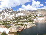 |
 |
 |
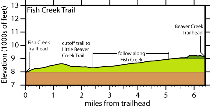
| Fish Creek Trail | Roundtrip: 12.8 miles Total elev. chg.: 2,060' High elevation: 9,186' Rating: easy TH open year round |
This follows its namesake for almost half its length, passing through forest and small meadows. It also climbs over a forested ridge that allows glimpses of the alpine peaks of the Mummy Range to the north. | 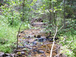 |
 |
 |
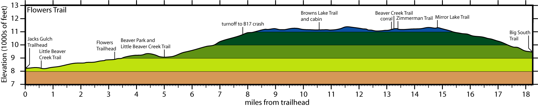
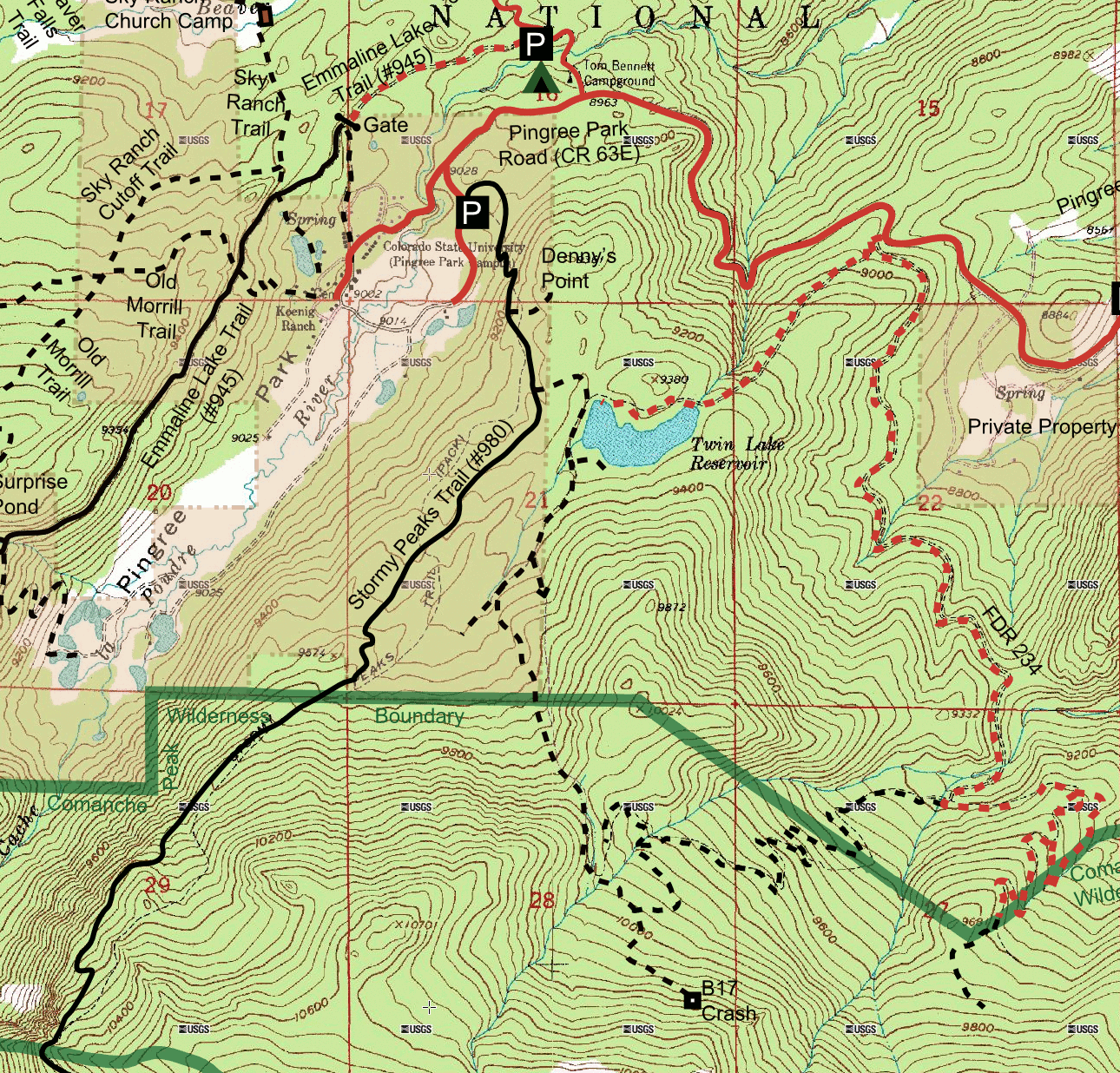
| Flowers Trail and Crown Point B17 Crash Hike |
Roundtrip: 30.0 miles Total elev. chg.: 6,283' High elevation: 11,318' Rating: difficult TH open early June - late October |
This old pioneer road is by far the longest trail in the Comanche Peak Wilderness and is for those who want to see it all: dense quiet forests, gently burbling streams, sweeping panoramic views, sheltered mountain lakes, small grassy meadows, and delicate alpine flowers. |  |
 |
 |
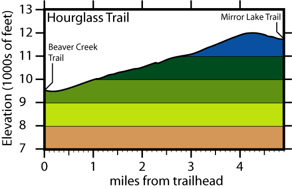
| Hourglass Trail | Roundtrip: 14.0 miles Total elev. chg.: 3,930' High elevation: 11,963' Rating: difficult TH open mid-June - late October |
This trail starts at Comanche Reservoir, follows along a splashing creek for a ways, and then climbs through the forest onto the alpine tundra. The views from on top are wonderful. |  |
 |
 |
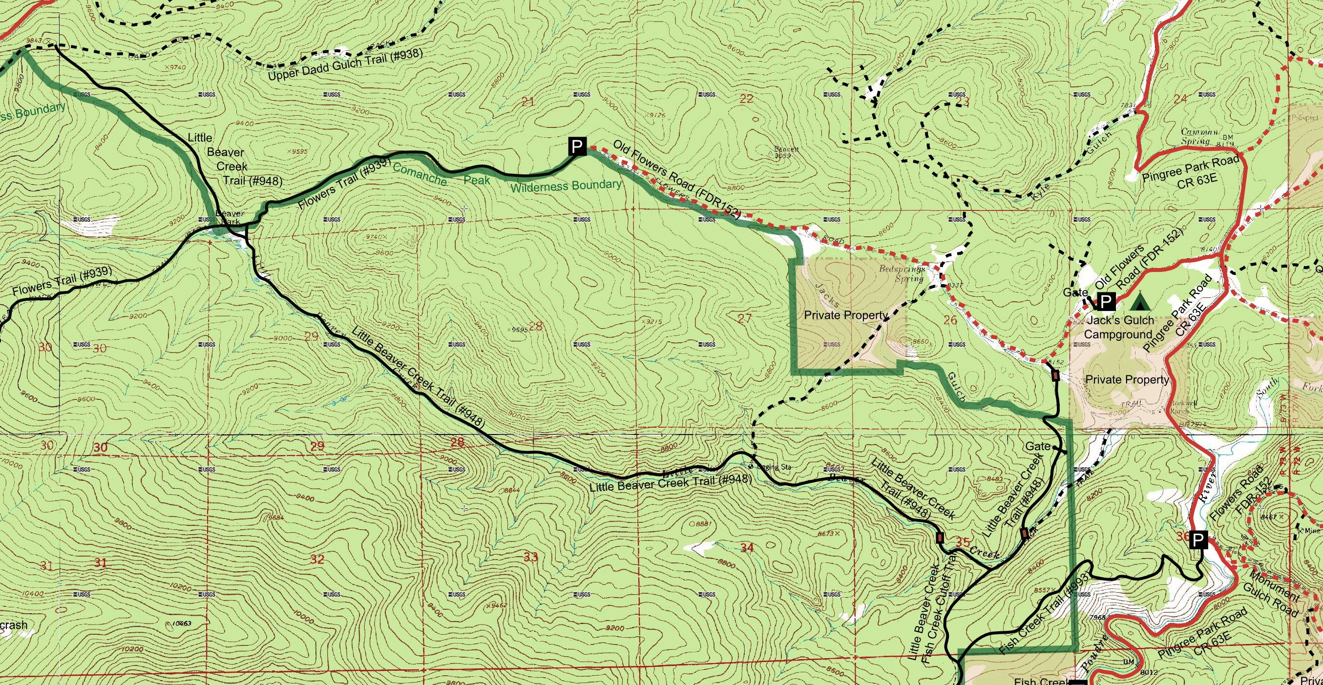
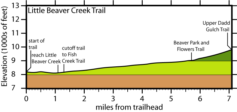
| Little Beaver Creek Trail | Roundtrip: 14.2 miles Total elev. chg.: 2,211' High elevation: 9,797' Rating: easy TH open early June - late October |
This is a pleasant trail that follows along gently cascading Little Beaver Creek for much of its length. Most of the trail resides in cool, shady forest, although there are also a few meadows, including the beautiful Beaver Meadow. | 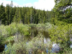 |
 |
 |
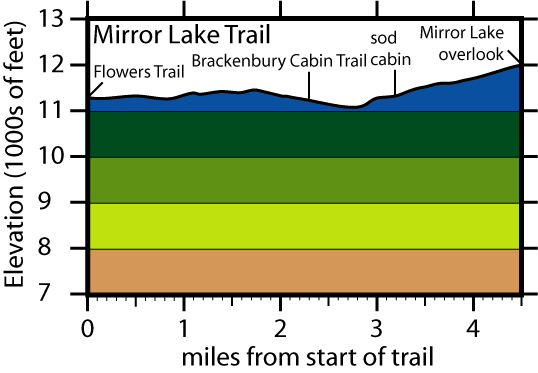
| Mirror Lake Trail | Roundtrip: 17.2 miles Total elev. chg.: 3,417' High elevation: 12,017' Rating: moderate TH open mid-June - late October |
This remote trail allows one to have a variety of alpine views, which you will likely have all to yourself. The two greatest highlights of this trail are the sod cabin, and the magnificent Mirror Lake overlook. | 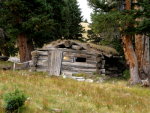 |
 |
 |
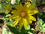
| Mummy Pass Trail | Roundtrip: 14.4 miles Total elev. chg.: 3,113' High elevation: 11,461' Rating: moderate TH open mid-June - late October |
Following a forested ridgeline, this trail climbs above timberline and tops out on a narrow alpine plateau, eventually dropping down to Mummy Pass. A profusion of alpine wildflowers line the trail in the summer. | 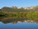 |
 |
 |
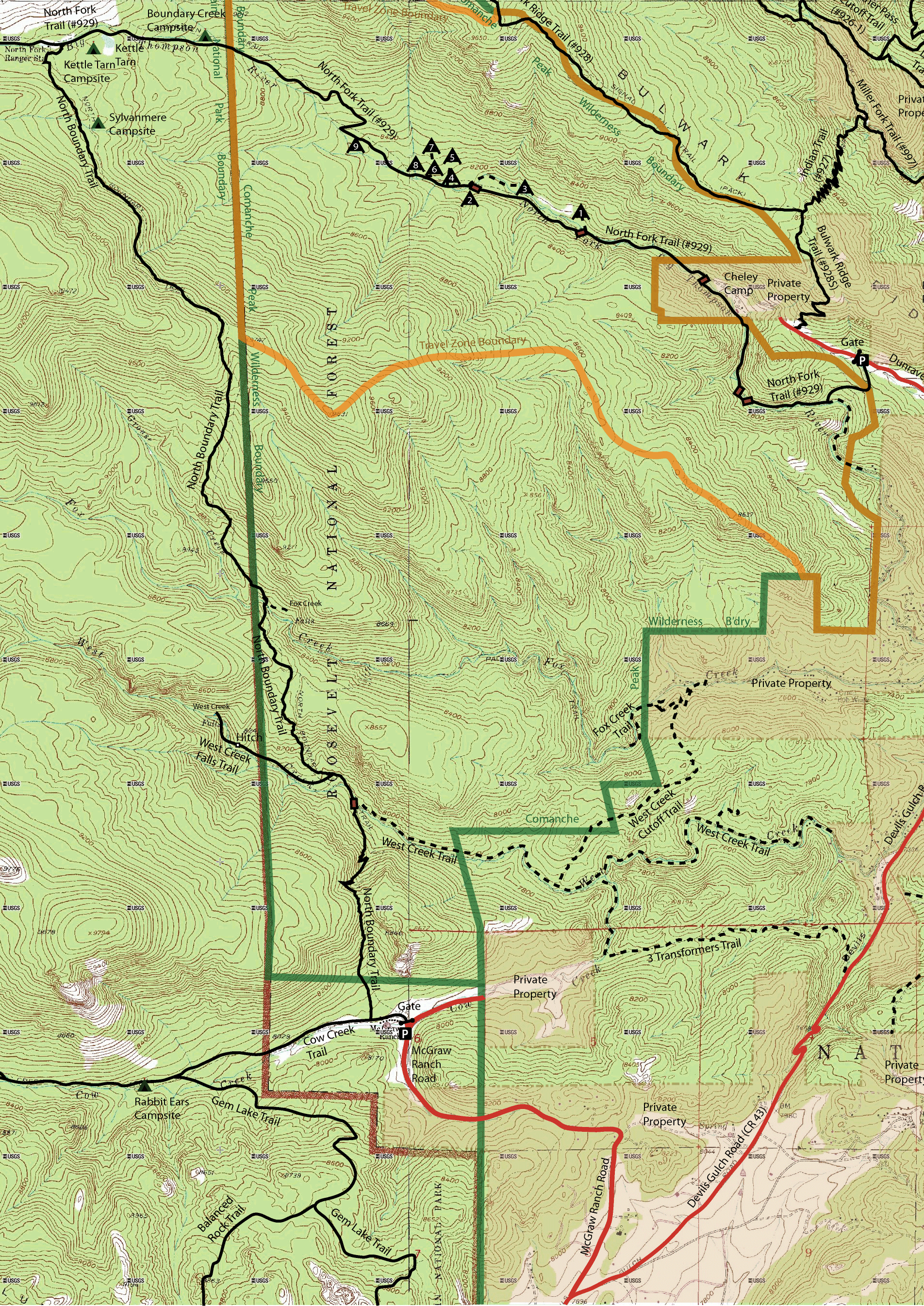
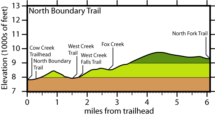
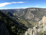
| North Boundary Trail and West Creek & Fox Creek Falls |
Roundtrip: 12.2 miles Total elev. chg.: 3,885' High elevation: 9,710' Rating: difficult TH open year round |
This is the only trail in the Comanche Peak Wilderness that provides access to waterfalls: West Creek Falls and Fox Creek Falls. The most appealing aspects of the trail itself are its rugged beauty and peaceful solitude. | 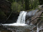 |
 |
 |
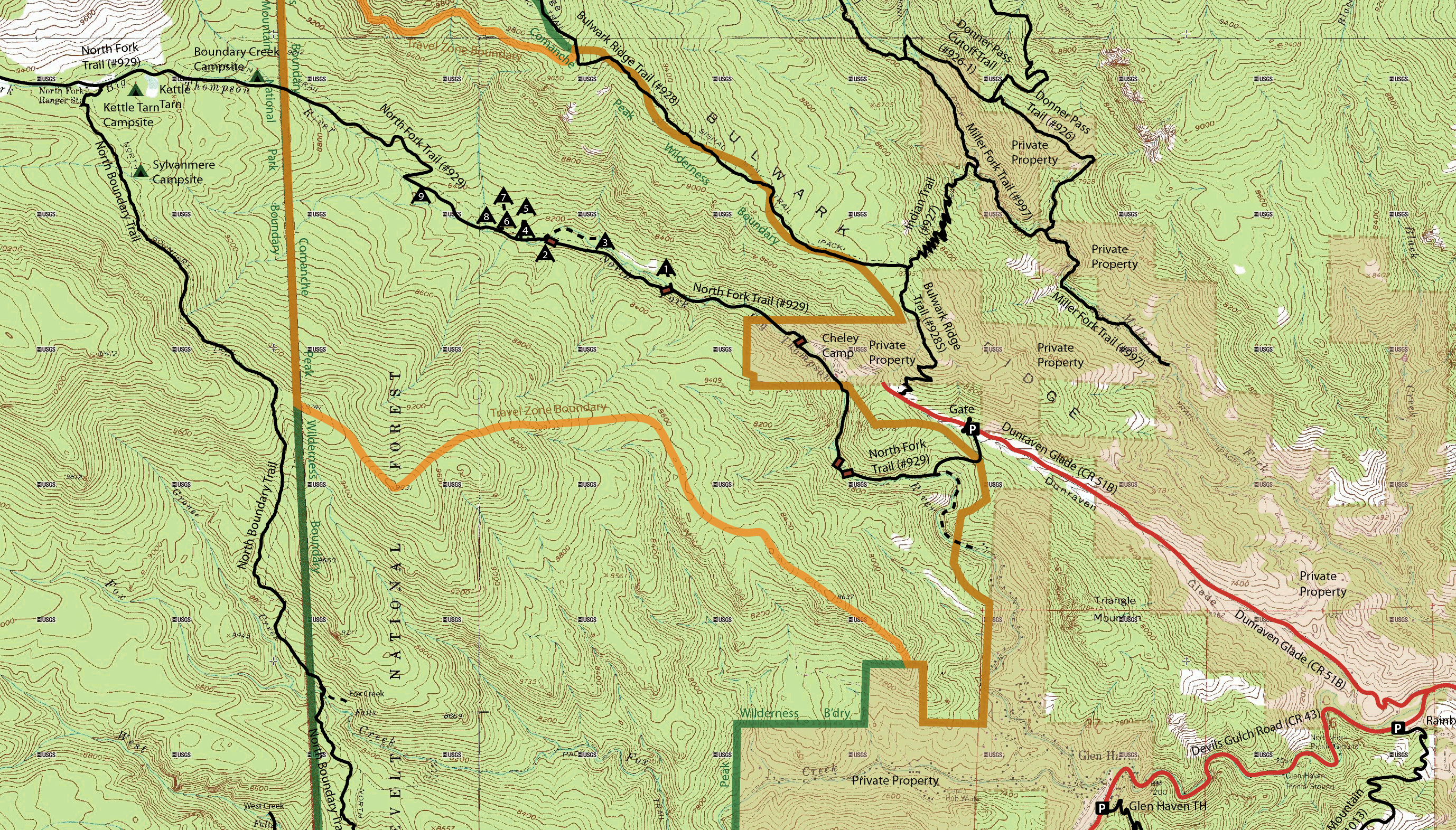
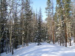
| North Fork Trail | Roundtrip: 10.6 miles Total elev. chg.: 2,108' High elevation: 9,278 Rating: moderate TH open year-round |
This is a great trail in any season if you like pleasant hikes in the forest, by streams and through small meadows, as it follows the North Fork of the Big Thompson River, providing lush habitat for wildlife and good fishing opportunities. | 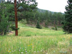 |
 |
 |
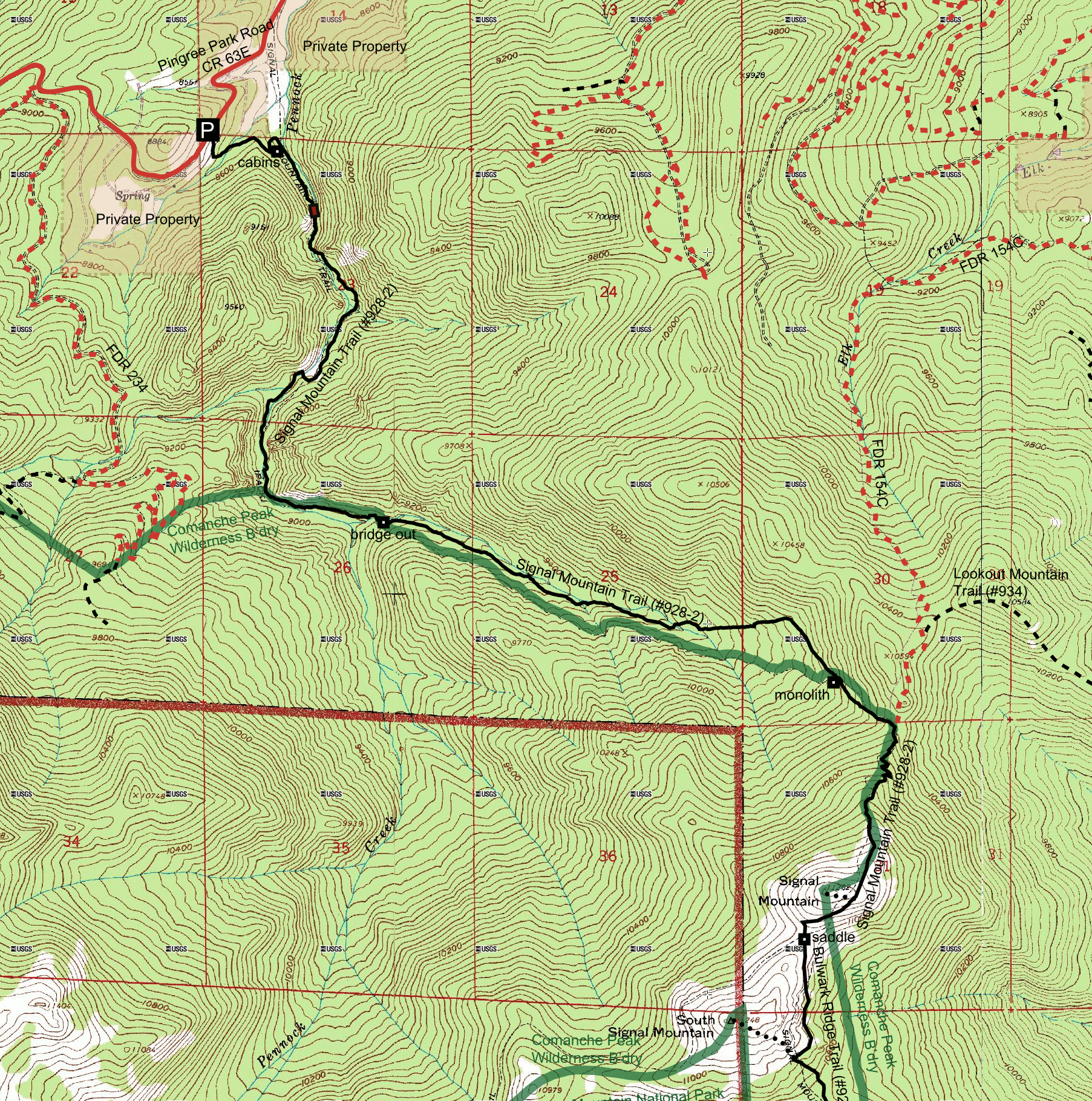
| Signal Mountain Trail | Roundtrip: 12.0 miles Total elev. chg.: 3,104' High elevation: 11,200' Rating: difficult TH open year round |
The lower portion of this trail follows the pleasant banks of Pennock Creek through shady forest at the bottom of a deep valley, while the upper portion tops out on the alpine tundra on the flank of Signal Mountain. | 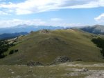 |
 |
 |
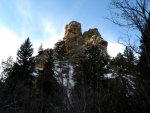
| Sleeping Elephant Mountain Hike | Roundtrip: 2.2 miles Total elev. chg.: 1,312' High elevation: 9,145' Rating: difficult best done in fall |
This short, but very steep off trail hike takes you to the top of the most-recognized peak in the wilderness area. | 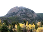 |

|  |
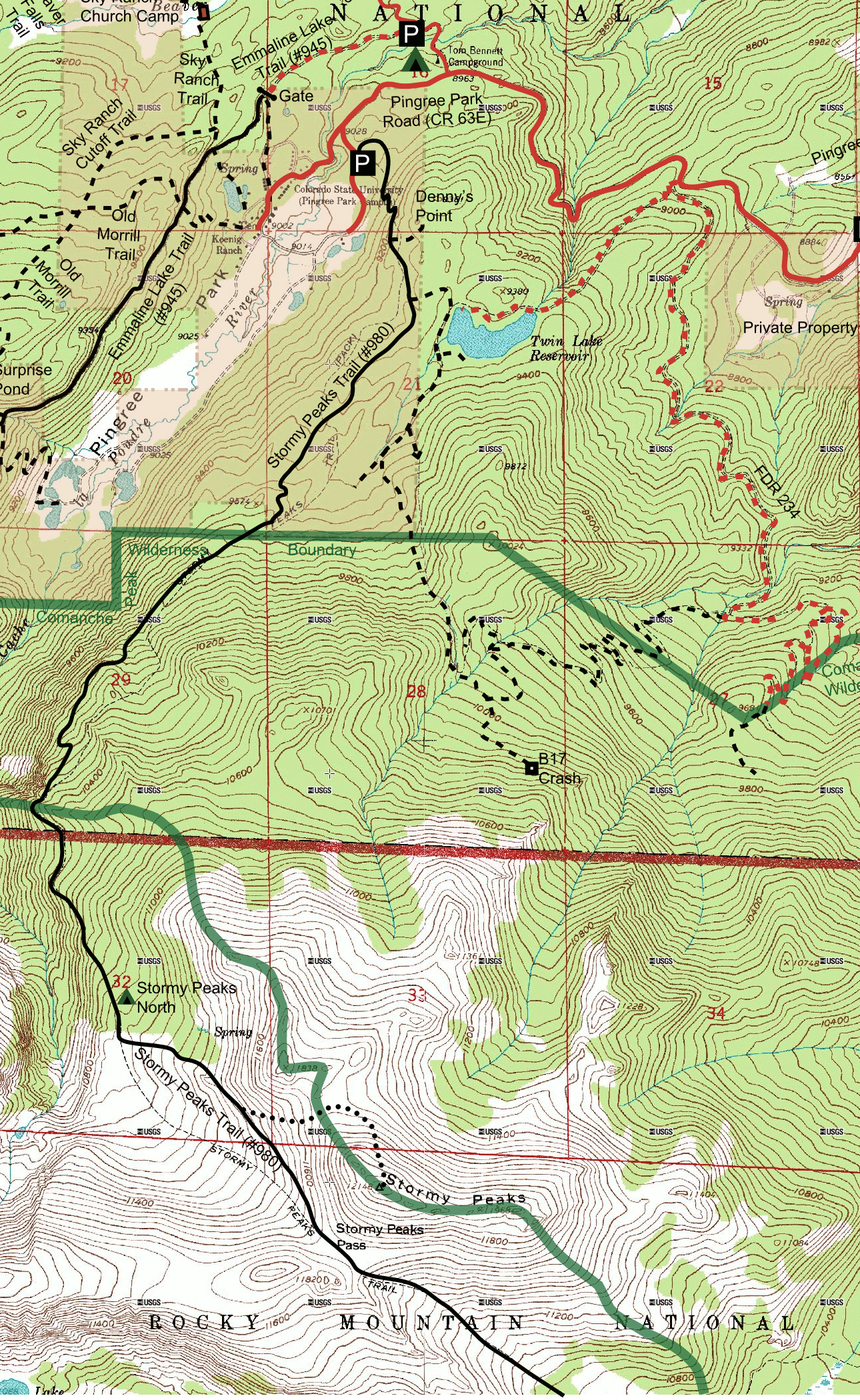
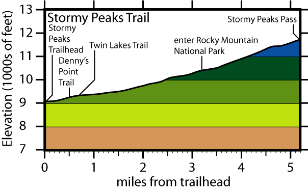
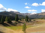
| Stormy Peaks Trail | Roundtrip: 10.4 miles Total elev. chg.: 2,703' High elevation: 11,667' Rating: difficult TH open year round |
This four-season trail allows you to have a wide range of hikes, depending on what you feel like doing. The actual trail itself passes through mostly evergreen forest, and eventually climbs above timberline, topping out at Stormy Peaks Pass. | 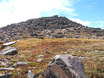 |
 |
 |
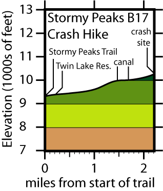
| Stormy Peaks/Pingree Park B17 Crash Hike | Roundtrip: 12.0 miles Total elev. chg.: 1,299' High elevation: 10,195' Rating: moderate TH open year round |
This hike takes you to the site of a B17 bomber crash, which occurred during the Second World War. There are also nice views along the way. |  |
 |
 |
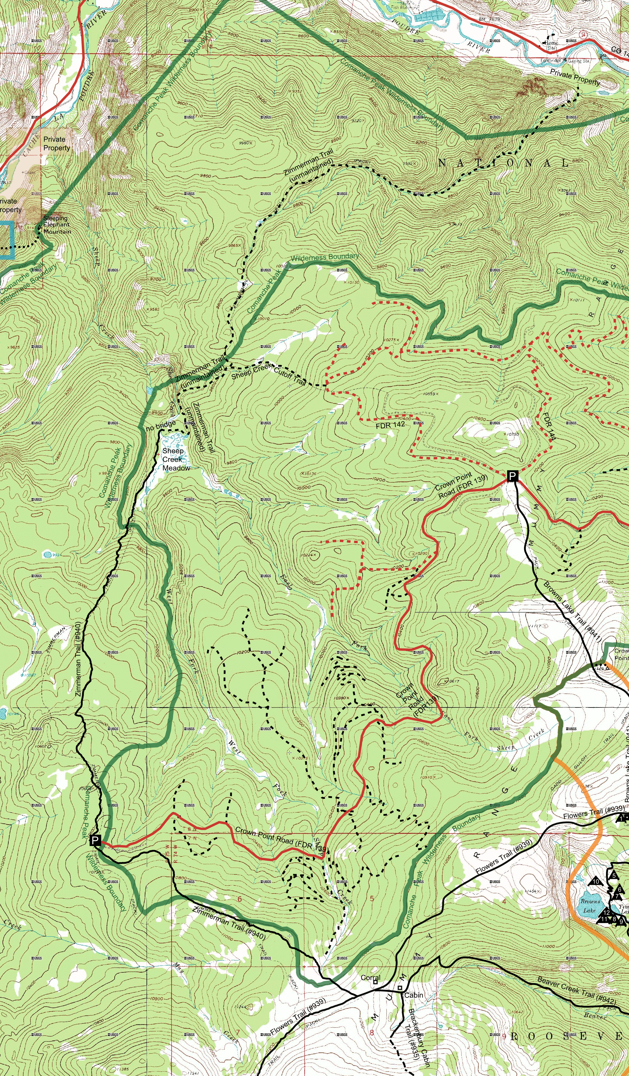
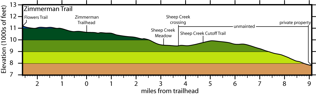
| Zimmerman Trail | Roundtrip: 12.6 miles Total elev. chg.: 2,294' High elevation: 11,164' Rating: moderate TH open mid-June - late October |
The southern section of this trail provides quick access to the open expanses of the alpine tundra, while the northern section winds through shady forest before reaching the most beautiful meadow of any trail in this guide. | 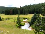 |
 |
 |
 |
Hike to Grass Lake via the Big South Trail June 20, 2015 |
 |
Big Bend Bump and Ranked Peak 10980 Hike October 4, 2014 |
 |
Long Draw 10ers Hike September 24, 2014 |
 |
East Stormy Peak Trail August 30, 2013 and July 8, 2014 |
 |
Big South 10ers Hike December 28, 2013 |
 |
Big South 9ers Hike December 8, 2013 |
 |
Upper Dadd Gulch Trail August 14, 2011 |
 |
Hike to the Hidden Lakes in the Northwest Corner of the Comanche Peak Wilderness September 12, 2010 |
 |
Fox Creek and West Creek Cutoff Trails July 17, 2010 |
 |
West Creek Trail January 30 and July 17, 2010 |
 |
Hike to ranked peak 9740' September 26, 2009 |
 |
Hike to ranked peak 11,859' August 29, 2009 |
 |
Hike to ranked peak 9980' March 8, 2008 |
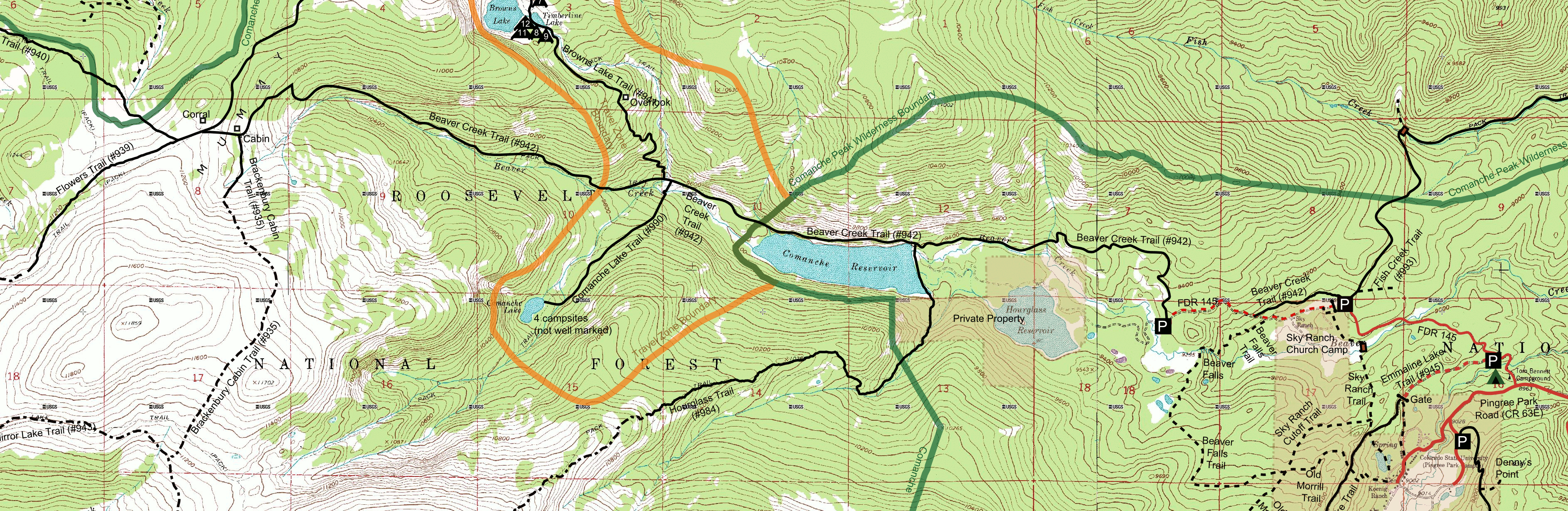
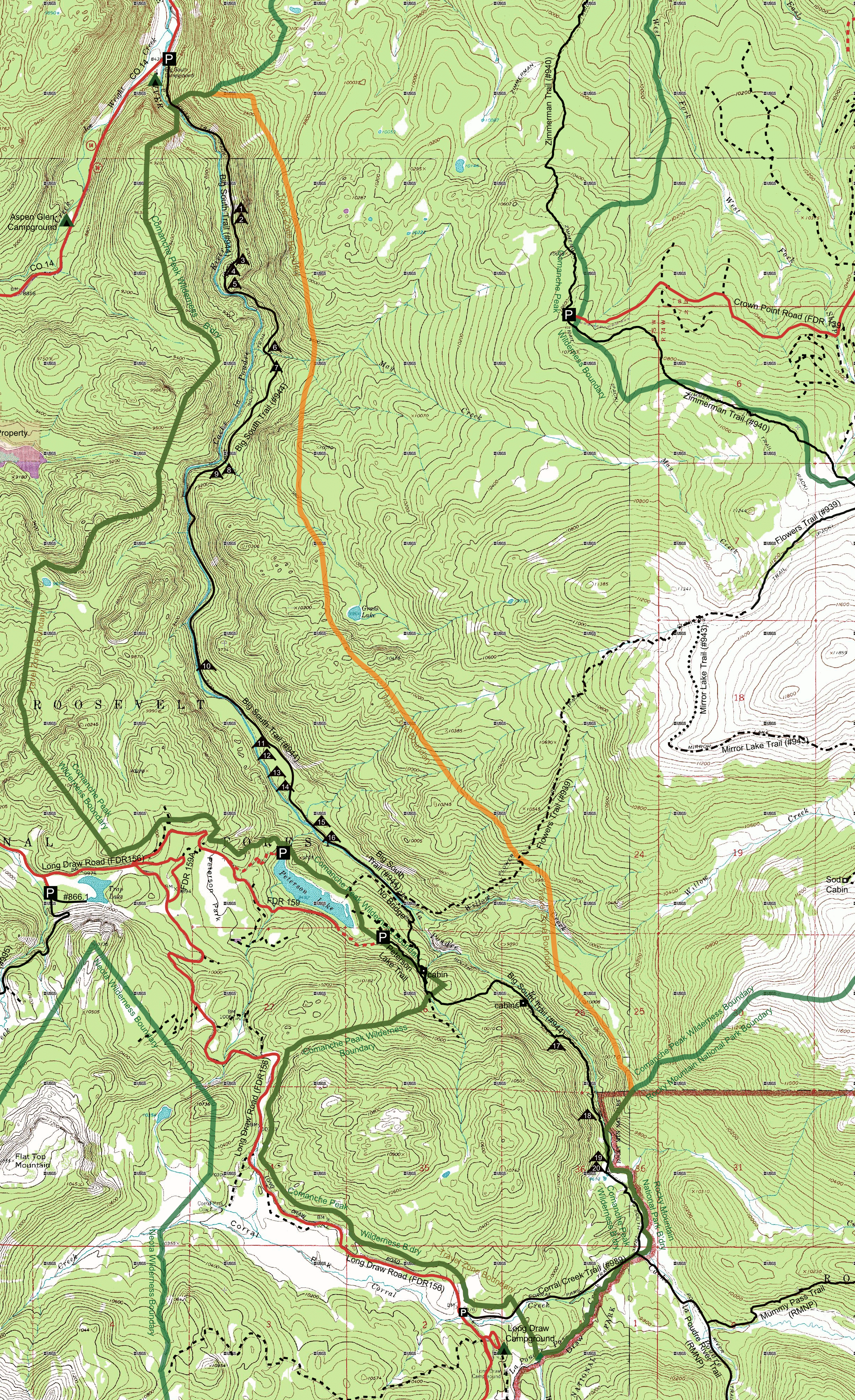
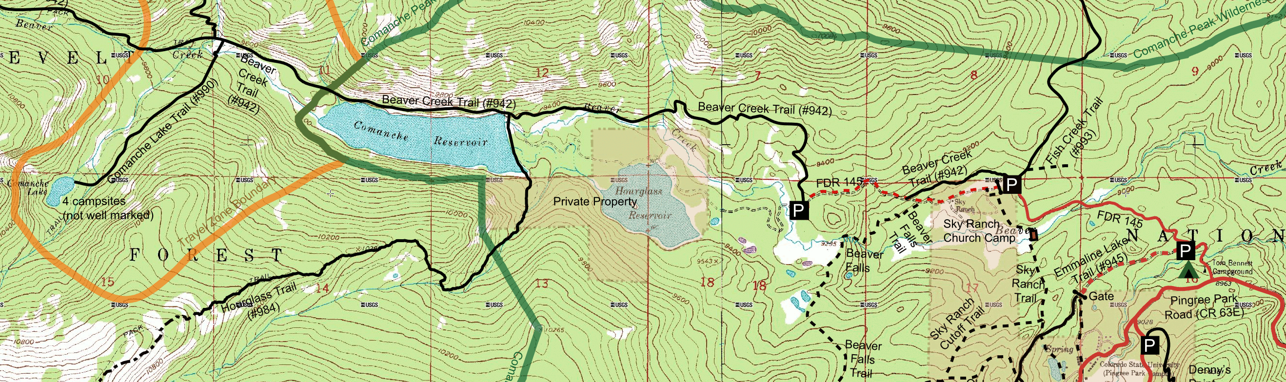
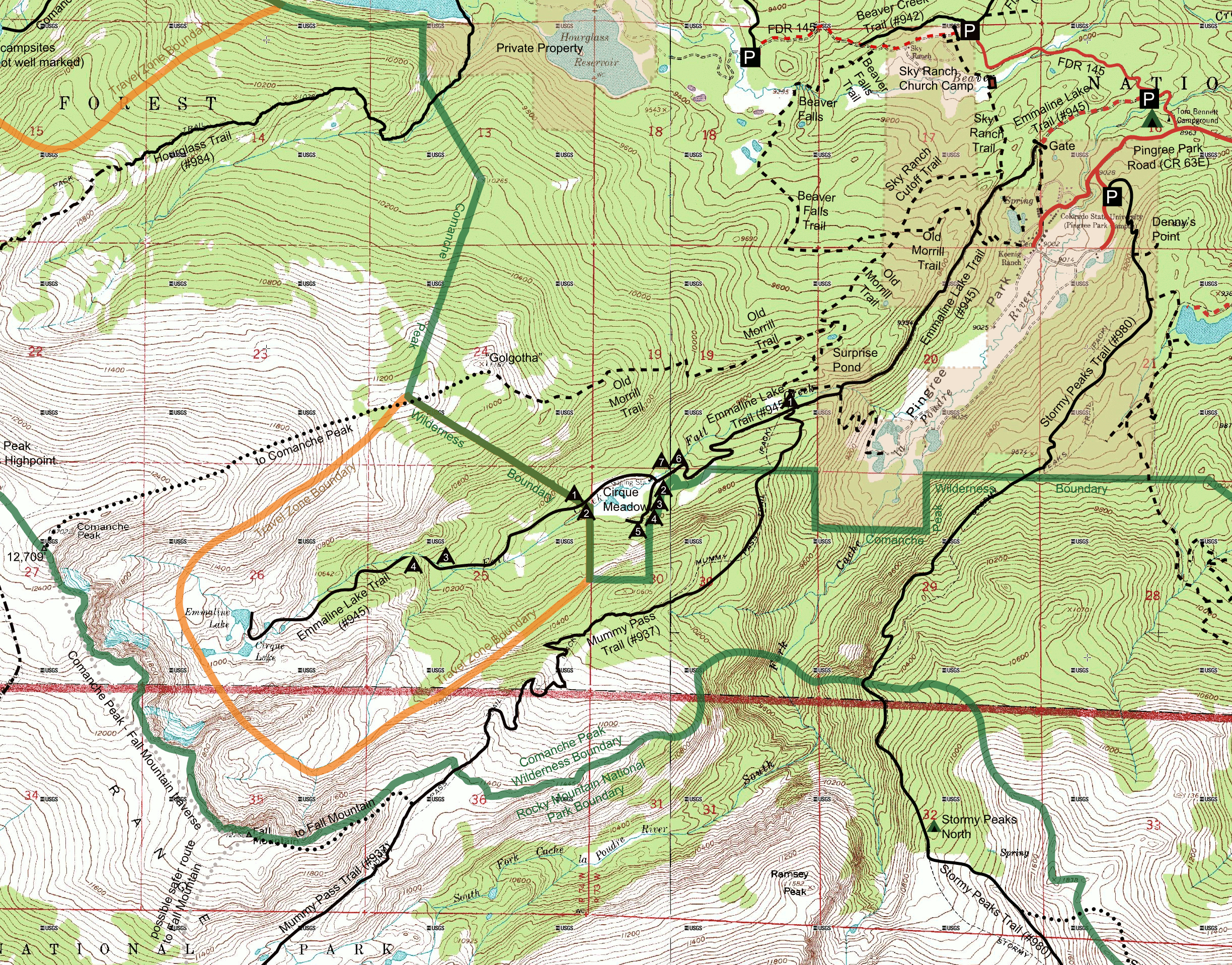
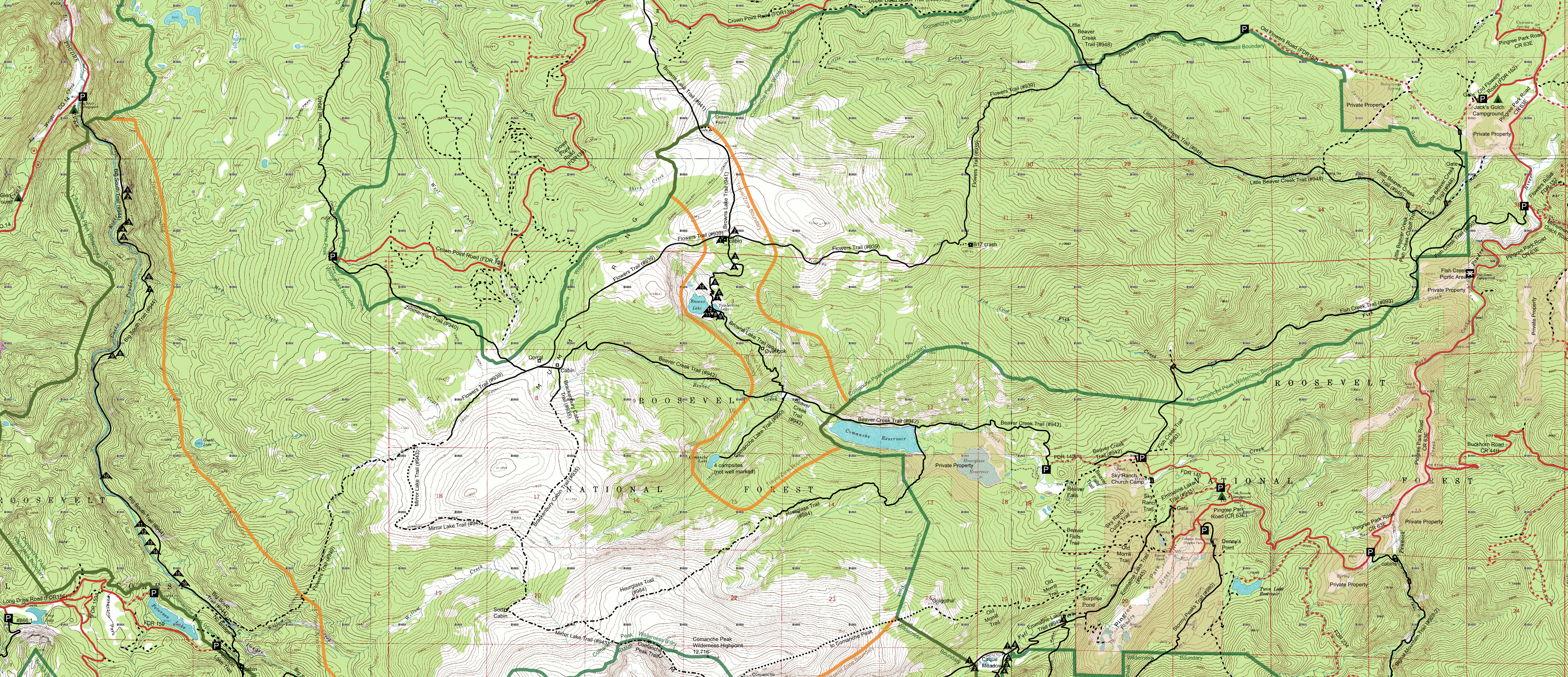
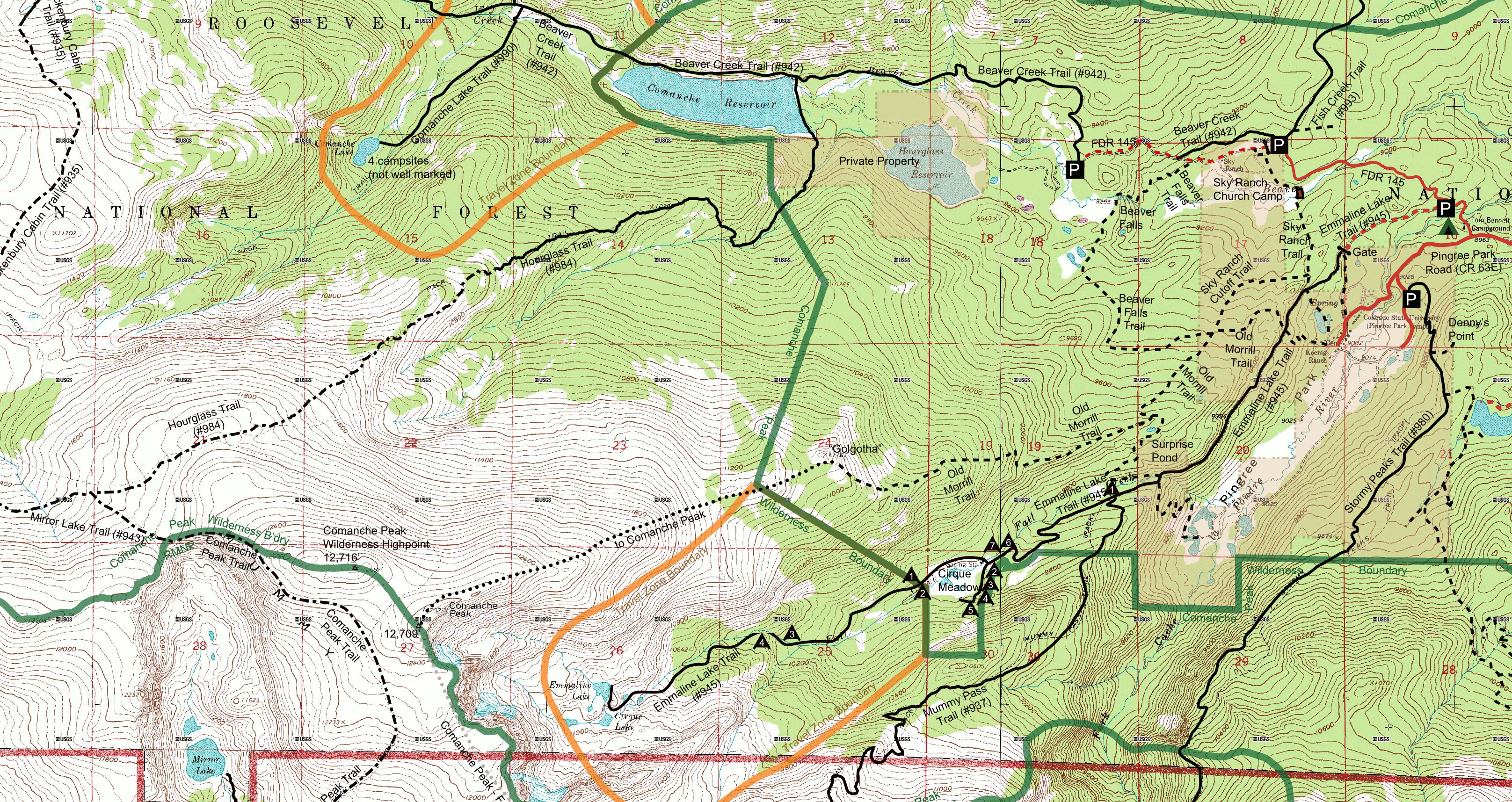
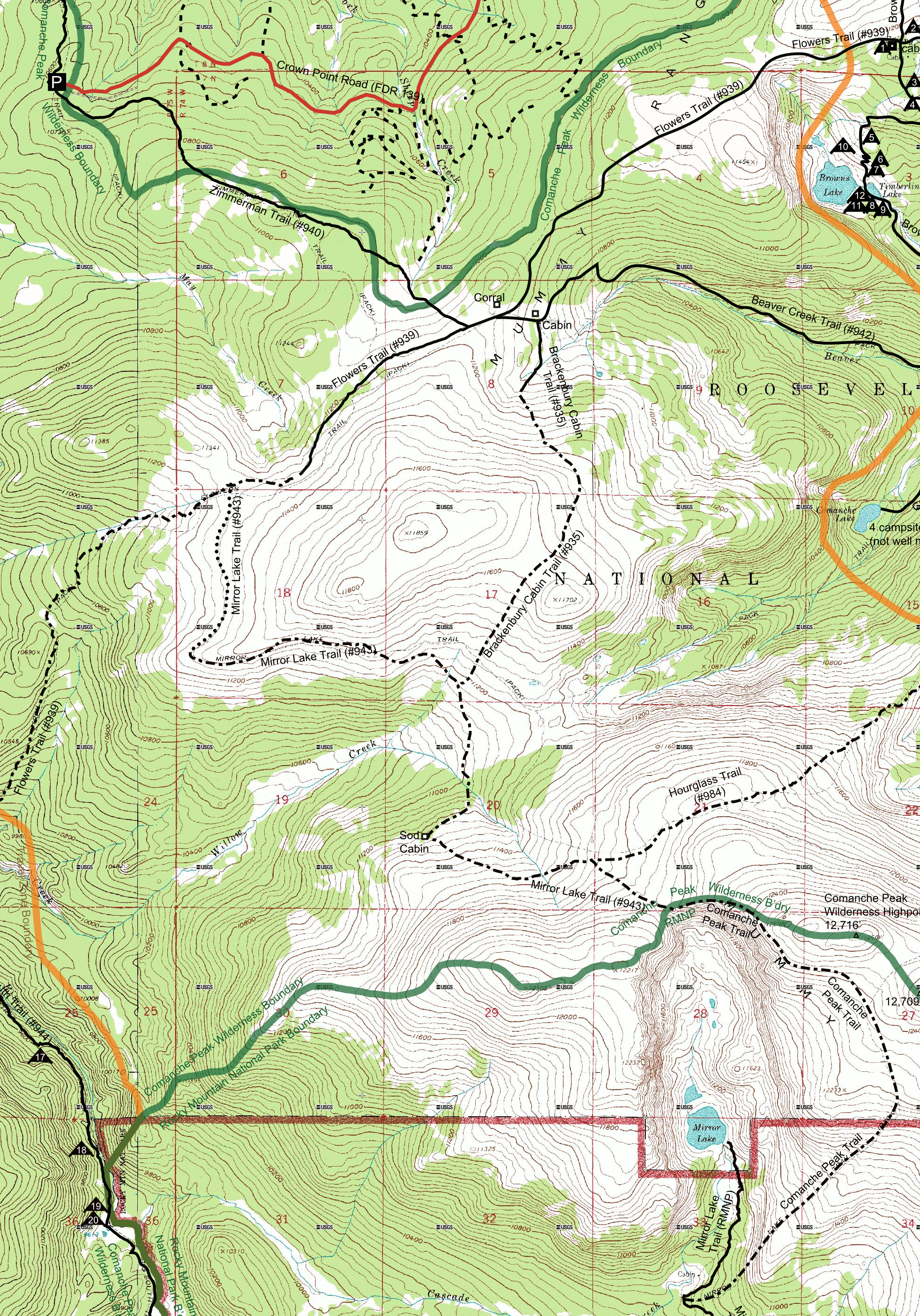
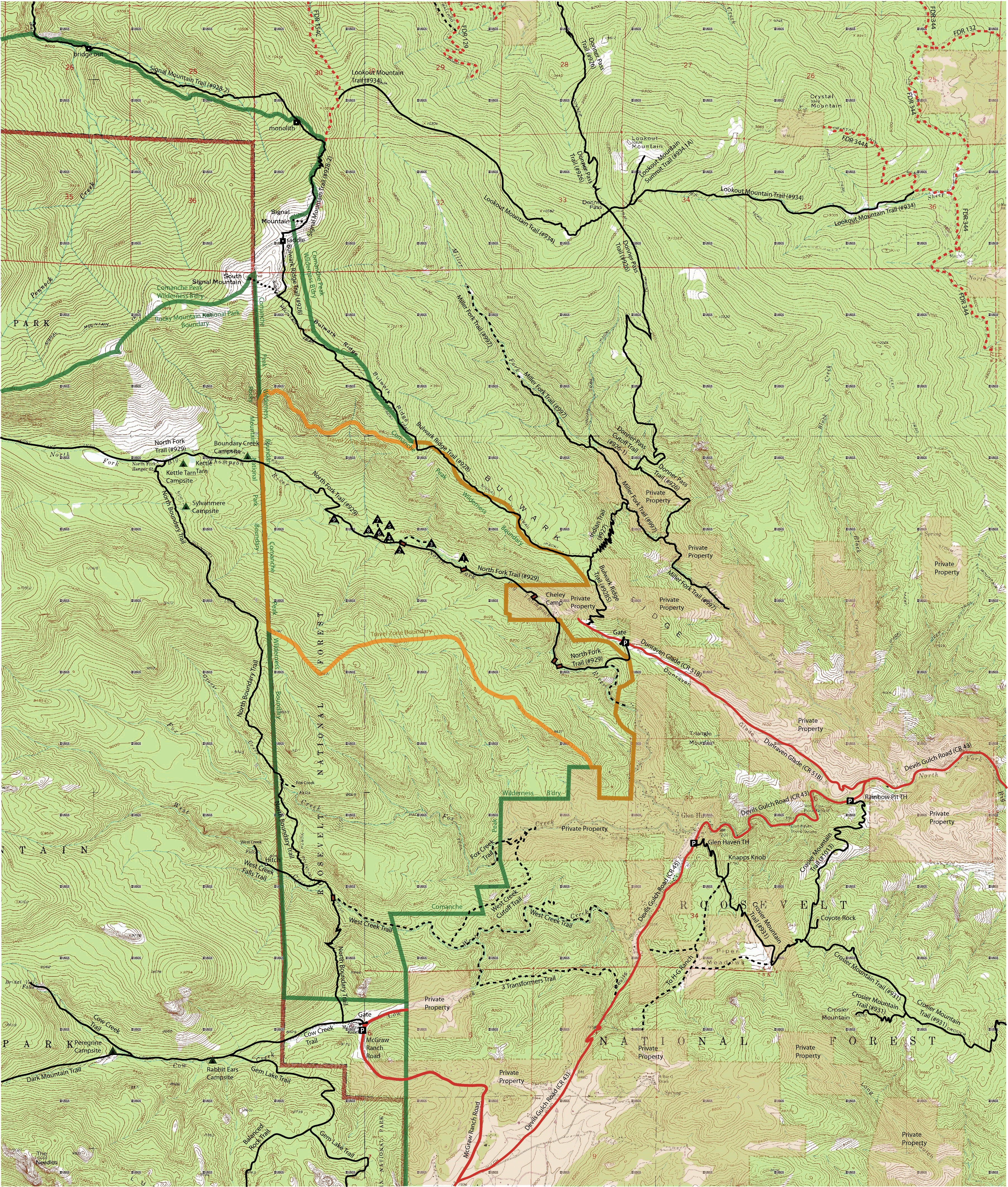
| Topo map of entire Comanche Peak Wilderness Area north of RMNP | Topo map of SE section of Comanche Peak Wilderness Area |
 |
 |
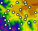 |
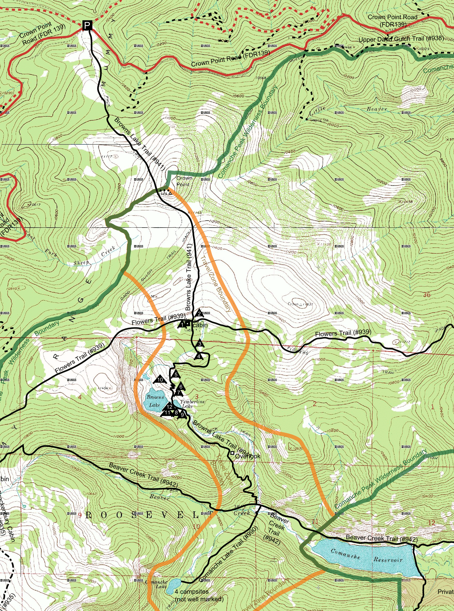
Clickable map of Comanche Peak Wilderness area Trails and Hikes |
 |
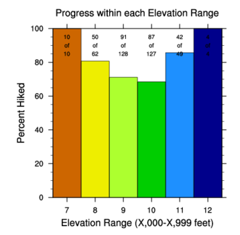
1 km UTM grid squares we have hiked We also have a Google KML version of the grid Bar chart showing percentage hiked by elevation |
