

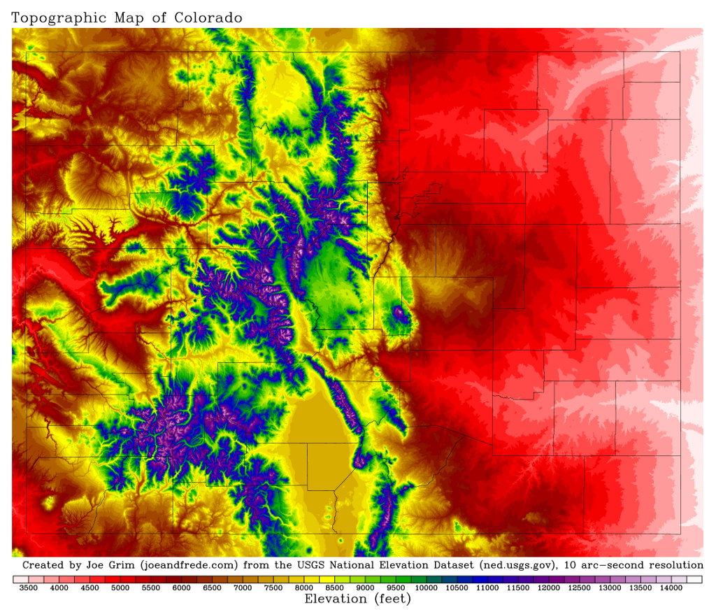
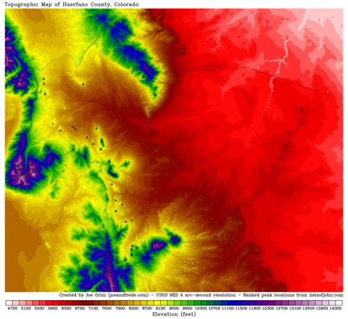
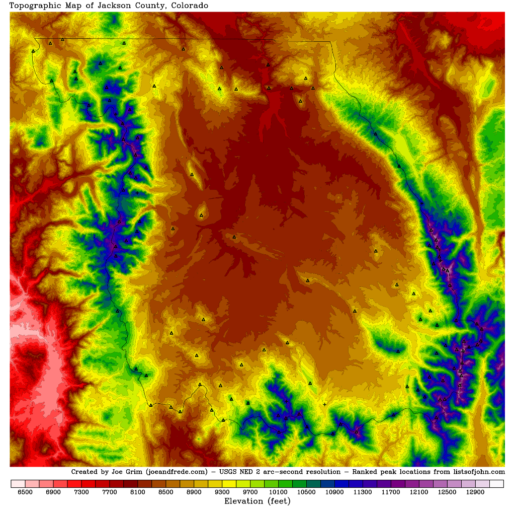
low resolution
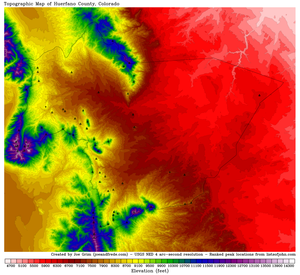
medium resolution
very high print-quality resolution

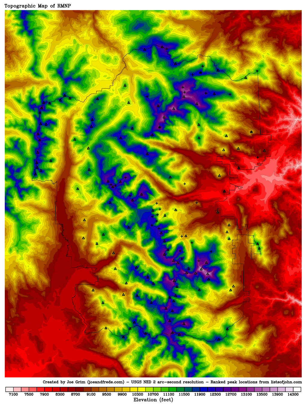
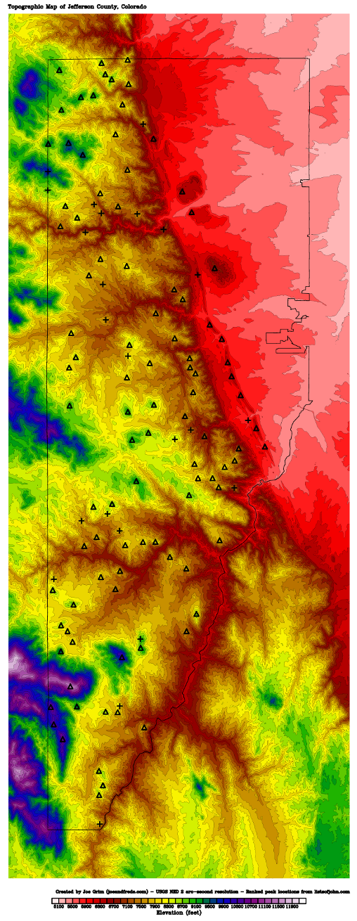
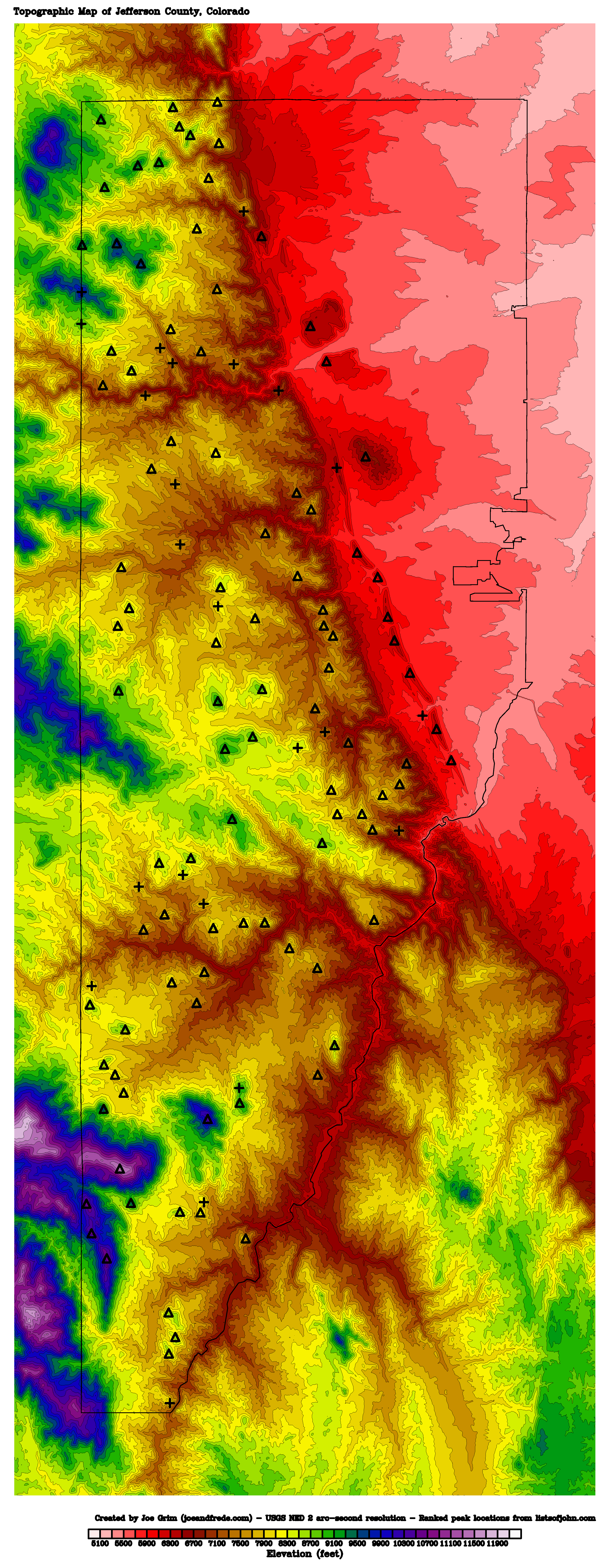
low resolution
medium resolution
very high print-quality resolution

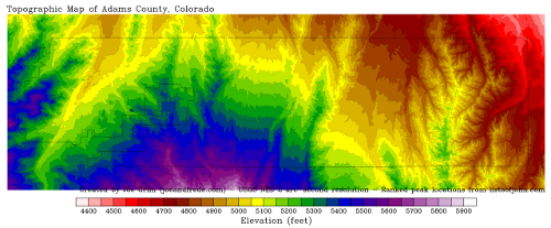
low resolution
medium resolution
very high print-quality resolution
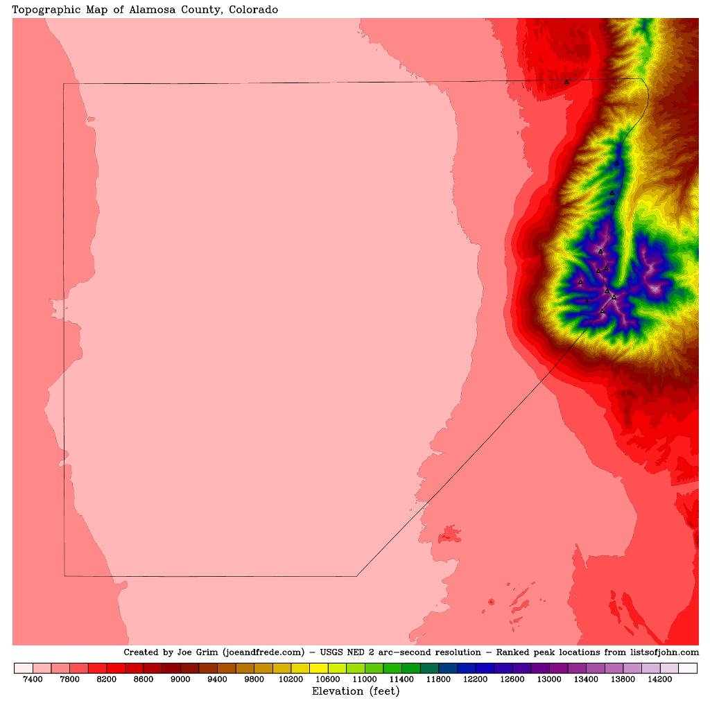
low resolution
medium resolution
very high print-quality resolution

low resolution
medium resolution
very high print-quality resolution

low resolution
medium resolution
very high print-quality resolution

low resolution
medium resolution
very high print-quality resolution

low resolution
medium resolution
very high print-quality resolution

low resolution
medium resolution
very high print-quality resolution
low resolution
medium resolution
very high print-quality resolution
older very high print-quality resolution with all peaks labeled

low resolution
medium resolution
very high print-quality resolution

low resolution
medium resolution
very high print-quality resolution

low resolution
medium resolution
very high print-quality resolution
low resolution
medium resolution
very high print-quality resolution

low resolution
medium resolution
very high print-quality resolution

low resolution
medium resolution
very high print-quality resolution
low resolution
medium resolution
very high print-quality resolution

low resolution
medium resolution
very high print-quality resolution
low resolution
medium resolution
very high print-quality resolution

low resolution
medium resolution
very high print-quality resolution
low resolution
medium resolution
very high print-quality resolution
low resolution
medium resolution
very high print-quality resolution
low resolution
medium resolution
very high print-quality resolution

low resolution
medium resolution
very high print-quality resolution
low resolution
medium resolution
very high print-quality resolution

low resolution
medium resolution
very high print-quality resolution
low resolution
medium resolution
very high print-quality resolution

low resolution
medium resolution
very high print-quality resolution

low resolution
medium resolution
very high print-quality resolution

low resolution
medium resolution
very high print-quality resolution

low resolution
medium resolution
very high print-quality resolution
low resolution
medium resolution
very high print-quality resolution

low resolution
medium resolution
very high print-quality resolution
low resolution
medium resolution
very high print-quality resolution
low resolution
medium resolution
very high print-quality resolution

low resolution
medium resolution
very high print-quality resolution
low resolution
medium resolution
very high print-quality resolution

low resolution
medium resolution
very high print-quality resolution
low resolution
medium resolution
very high print-quality resolution
older very high print-quality resolution with all peaks labeled
low resolution
medium resolution
very high print-quality resolution
low resolution
medium resolution
very high print-quality resolution
low resolution
medium resolution
very high print-quality resolution
low resolution
medium resolution
very high print-quality resolution

low resolution
medium resolution
very high print-quality resolution
low resolution
medium resolution
very high print-quality resolution

low resolution
medium resolution
very high print-quality resolution

low resolution
medium resolution
very high print-quality resolution

low resolution
medium resolution
very high print-quality resolution
low resolution
medium resolution
very high print-quality resolution
low resolution
medium resolution
very high print-quality resolution
low resolution
medium resolution
very high print-quality resolution
low resolution
medium resolution
very high print-quality resolution
low resolution
medium resolution
very high print-quality resolution

low resolution
medium resolution
very high print-quality resolution

low resolution
medium resolution
very high print-quality resolution
low resolution
medium resolution
very high print-quality resolution

low resolution
medium resolution
very high print-quality resolution

low resolution
medium resolution
very high print-quality resolution

low resolution
medium resolution
very high print-quality resolution
low resolution
medium resolution
very high print-quality resolution
low resolution
medium resolution
very high print-quality resolution

low resolution
medium resolution
very high print-quality resolution

low resolution
medium resolution
very high print-quality resolution

low resolution
medium resolution
very high print-quality resolution
low resolution
medium resolution
very high print-quality resolution
low resolution
medium resolution
very high print-quality resolution

low resolution
medium resolution
very high print-quality resolution